| Home | Intro | PlatTect | IgRx | Physio.Map | X-sections | 1 Page - H | 2 Page - H | 16 Page - H | Wilson Cycle |
|
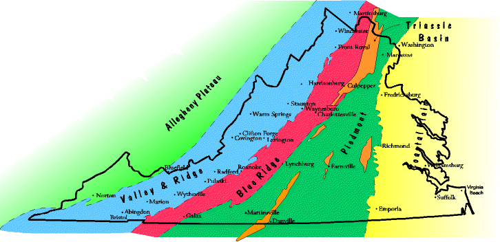
The Physiographic/Geologic Provinces of Virginia
The map below shows the five NE to SW trending belts that make up the state. Arranged side by side, from west to east they are: Allegheny Plateau, Valley and Ridge, Blue Ridge, Piedmont, and Coastal Plain. Each of these provinces more or less extends up and down the east coast from Georgia to New York.
|
| Virginia's landforms are strongly influenced by the geology under them, and the physiography (landforms) and geology (rock distributions) largely correspond. But this is not always the case. Exceptions are dealt with at the site "Description of Virginia Geology: Physiographic Provinces." |
| |
|||
| Last Update: 9/13/00 | |||