|
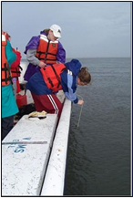
Measuring the Photic Zone Depth |
|
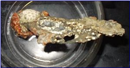
Ivory Bush Coral |
|
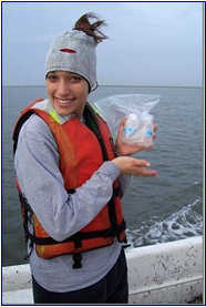
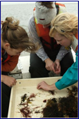
Properly Labeled Samples |
|
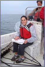
Recording Data |
|
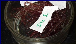
Common Red Seaweed |
|
Time: 8:05 a.m. to 8:15 a.m. Location: Inlet Latitude: N 37.58159 Longitude: W 75.61635 Note: While collecting data, we drifted approximately 0.5 mile.
Moon Phase: Waxing Crescent High Tide Time: 11:13 a.m. Low Tide Time: 4:30 a.m. |
|
METEROLOGICAL DATA Air Temperature: 24.3°C Wind Direction: SE Wind Speed: 12 knots % Cloud Cover: 98% Weather Conditions: drizzly, mostly cloudy, cool, rain from the night before promoted water mixing. |
|
PHYSICAL AND CHEMICAL WATER DATA Total Water Depth: 7-10 ft Photic Zone Depth: .75 meters Wave Height: 10 cm Tide Stage: mid-tide, changing from low to high Current Direction: Changing (all but east) Current Speed: 2.6 knots Phosphate Amount: 0 ppm Nitrate Amount: 0 ppm |
|
RESULTS OF SURFACE AND PROFILE MEASUREMENTS |
|
BIOLOGICAL DATA |
|
SEDIMENT DATA |
|
Sand [2.5Y(4/4)] olive brown |
|
Depth |
Temperature (C) |
Salinity (ppt) |
DO (mg/L) |
pH |
|
Surface (0) |
23.6 |
31.3 |
5.8 |
8.00 |
|
0.5 |
23.6 |
31.4 |
5.66 |
|
|
1 |
23.6 |
31.4 |
5.89 |
|
|
1.5 |
23.7 |
31.5 |
5.87 |
8.02 |
|
2 |
23.7 |
31.5 |
5.6 |
|
|
2.5 |
23.6 |
31.4 |
5.7 |
8.00 |
|
Animals Found |
Plants Found |
Plankton Found |
|
|
Trawl |
Dredge |
||
|
Hydriods- (Burentslia species) |
Common Red Seaweed Wire Weed Ahnfeltia Plicata |
Jingle Shell |
Actinopods |
|
Bay Anchovy (anchoa Michelli) |
Slipperytangle weed sphaerotrichia divaricata |
Owlina Arbuscula |
Copepods |
|
Hermit Crab (Pagarus Acadianus) |
Ivory Brush Coral |
Pteropods |
|
|
Star Coral |
|||
|
Astrangia Danae |
|||