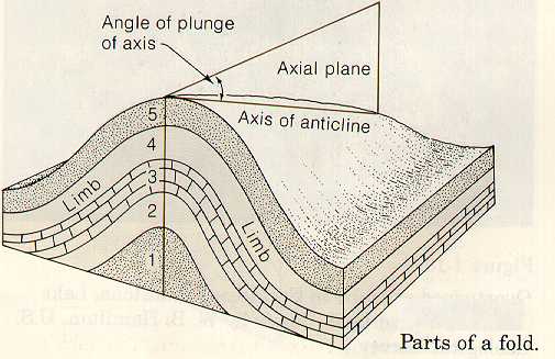
Anticline/
Syncline
Anticline: A fold shaped convex up, like an upside down U. The core contains the oldest rocks.
Syncline: A fold shaped convex down, like a U. The core contains the youngest rocks.
| Block Diagram of a Syncline |
Carbonate Rock
A type of sedimentary rock that forms in quiet marine environments. Contains the fundamental anionic structure CO3-2. Examples include limestone and dolomite. Also known as detrital.
Clastic Rock
Short for siliciclastic. Non- carbonate sedimentary rocks. Composed of sediment from pre-existing rocks that was transported, deposited, and compacted into a solid form. Also known as non- detrital.
Divergant
Continental Margin
The calm before the storm. A slow separation of continental mass, this process often results in clear quiet ocean environments where carbonate rocks and abundant sea life flourish. DCM’s occur before and after the more violent actions of mountain building collisions.
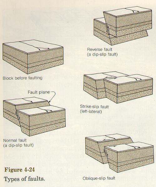
Fault
A planar or curving fracture in the crust where the rock on one side of the fault moves higher or lower than the other side.
|
 |
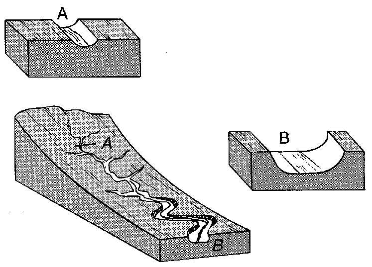
Gradient (Stream)
This property of streams and rivers illustrates the relationship that exists between the distance water flows and the elevation change it undergoes. Elevation is the height of a place above sea level. Small distances and large elevation changes yield a high gradient, and this often translates to faster moving
water. The diagram below relates how gradient affects the shape of river beds.
Igneous Rock
Intrusive Igneous Rocks form from the fractional melting and crystalization (cooling and solidification) of magmas at depth in the Earth. Different minerals crystallize and leave the melt at different temperatures and pressures, allowing a great variety of igneous rock types to develop.
Extrusive Igneous Rocks form from the cooling of lava at the Earth’s surface.
Select the highlighted text to view more about igneous rocks and their evolution.
Incisement
When tectonic uplift (mountain building) occurs in an area, stream gradients increase, as do the abilities of streams/rivers to erode the strata beneath them. Sometimes the rate of stream incisement (downcutting) is able to keep up with the rate of uplift, leaving a notch in the mountains that form.
Karst
For Cavers:
A playground.
For Geologists: A landscape formed by the dissolution of carbonate rocks. In the Shenandoah
Valley, karst topography includes sinkholes, caves, and abundant underground drainage.
| Conglomerates are sedimentary rocks assembled from a jumble of rock fragments whose edges have been smoothed by erosion. Nature's own cement is found in these rocks, and it is called matrix. When mtrix surrounds the fragments so they do not touch, the rock is matrix-supported. (This is as opposed to grain-supported, in which no space exists between fragments.) |  |
Metamorphic
Rock
Any rock (sedimentary, igneous, or metamorphic) that undergoes a physical and chemical alteration short of melting, resulting from changes in temperature and pressure at depth.
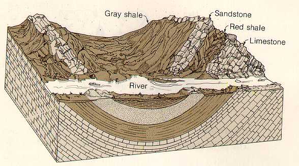
Outcrop
Any surface exposure of rock units. Thefollowing diagram relates minerals, rocks, and outcrops.
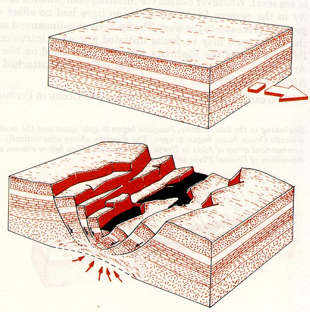
Orogeny
A mountain building event.
Principle of Cross-Cutting Relations
Helps to determine relative ages of geologic features. When any geologic feature (A) cuts through any geologic feature (B), then (A) is younger than (B).
Rock Cycle
The process by which rocks are made and unmade within and on the surface of the Earth. The rock cycle interrelates the formation processes of metamorphic, igneous and sedimentary rocks.
Diagram from "Geology and Virginia" pg 32.
Modify Diagram from Geologic Evolution of NA
Sedimentary
Rock
Forms on the Earth’s surface from the transportation and settling of sediment. This sediment results from the erosion of pre-existing igneous, metamorphic or sedimentary rocks, or from the biological debris that forms fossils. Clastic (non-carbonate) sedimentary rocks are classified according to their compositional
percentages of Quartz, Feldspar, and lithics (QFL). Each of these mineral/rock types can be indicative of a certain depositional environment. Plotting the sedimentary rock composition on a QFL diagram allows geologists to make interpretations about the environment at the time of deposition. (113 gena)
Strata
a layered unit of sedimentary rock; a bed.
Stratigraphy
Pertaining to the nature and interpretation of layered sedimentary rocks.
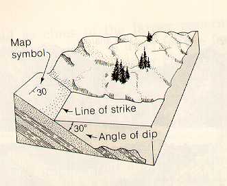
Trend
Measures the direction that the axial plane of a fold points. Most of the folds in and around the Shenandoah Valley trend Northeast, paralleling Route 81.