| ROUTE 81N
But before
you go, how about some home history?1-
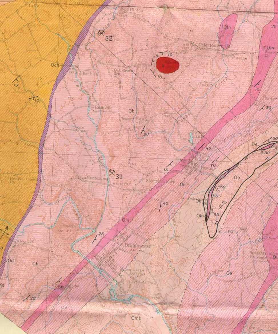
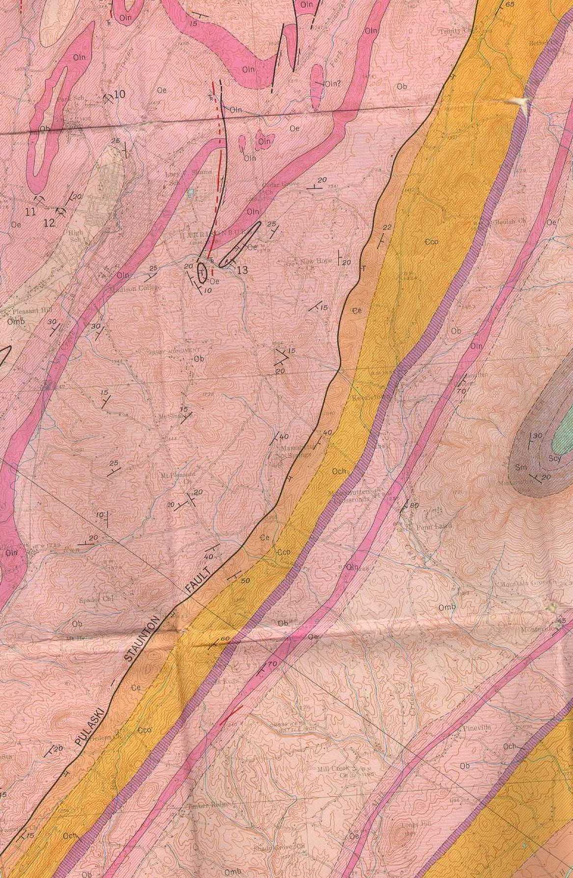
Harrisonburg sits sandwiched in the Shenandoah
Valley between two ridges. All the geology here is part of
The Valley and Ridge Province, one of five geologic provinces that comprise
Virginia. The eastern ridge is the Massanutten syncline,
visible in town as the unmiskakable sloping profile of Massanutten Mountain.
A glimpse of Virginia's
digital relief map shows that the Massanutten ridge is not the
eastern border of the Shenandoah Valley, but only a small range protruding
through the middle of it. West of town
is the Alleghany front, but the great sweep of the Valley between hides
a clear view.
Harrisonburg straddles two large folds that
are seperated by a minor reverse
thrust fault. Western Harrsionburg covers the Long Glade Syncline,
stacked bottom up with the Edinburg, Oranda and Martinsburg
formations. About 500 million years ago sediment--that would someday
be the limestone/shale, shale and sandstone beds (respectively) visible
throughout town-- drifted to the depths of a large ocean, the Protoatlantic.
This quiet deposition predicted the approach of a terrific collision to
the East coast shores. Click on the formation names to discover more about
the Taconic Orogeny and its small place in Virginia's geologic history.
To the East of Harrisonburg, near 81, is
the Middlebrook Anticline.
Pushed to the surface in this structure are the New
Market, Lincolnshire, and Edinburg Formations. Strewn casually in
most fields around Harrisonburg, these beds of micritic limestone and calcareous
shale provide further evidence that about 560 million years ago, Harrisonburg
sat in the muddy depths of a Protoatlantic Ocean. Notice that these beds
were deposited before the beds of the Long Glade Syncline, and the lack
of clastics
in them indicates a Divergant
Continental Margin. Even though all these beds were deposited
horizontally, like a stack of pankakes, folding since that depositional
period allows them to protrude through to the surface where they are visible
today.The folds in Rockingham county trend Northeast, like the ridges that
follow the trace of the Valley.
West of town, between Massanutten Springs
and Keezletown, runs the Pulaski- Staunton Fault. Though presently inactive,
this fault dips
east and trends Northeast a distance of about sixty five miles, and with
its displacement of between 2000- 4000 feet, it pushed to the surface some
of the dolomites and limestones of the Elbrook and
Conococheague Formations (respectively). Geologists determined the
age of this fault by using the principle
of cross-cutting relations. To help visualize this mesh of folding
and faulting, click on the geologic map below to see a cross- section of
the Harrsionburg area.
GEOLOGIC
MAP OF ROCKINGHAM COUNTY1
|