|
|
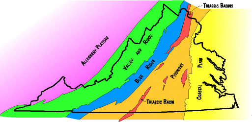
Route 81 travels near the
eastern limit of this province, which includes territory from the western
base of the Blue Ridge Mountains across the entire Shenandoah Valley and up
over a series of parrallel ridges to the Alleghany Plateau.
Carbonates, deposited mostly in the Lower
Paleozoic (Cambrian- Ordovician), and sedimentary rocks, aged Upper Paleozoic (Ordovician- Devonian), comprise the stratigraphy of this province. Since their deposition these rocks have undergone several mountain building events, and exist currently as a sequence of parallel synclines and anticlines trending Northeast. Thrust faults frequent the province, bulldozing the already complex structures into greater disarrangement.
Karst landforms in the Valley and trellis drainage patterns in the ridges are only some of the erosional processes that have worked for thousands of years to create the textured topography of ridges and valleys that give the province its name. sedimentary rocks, aged Upper Paleozoic (Ordovician- Devonian), comprise the stratigraphy of this province. Since their deposition these rocks have undergone several mountain building events, and exist currently as a sequence of parallel synclines and anticlines trending Northeast. Thrust faults frequent the province, bulldozing the already complex structures into greater disarrangement.
Karst landforms in the Valley and trellis drainage patterns in the ridges are only some of the erosional processes that have worked for thousands of years to create the textured topography of ridges and valleys that give the province its name. |
| Rising pale across Virginia's scape are the Blue Ridge Mountains, made imfamous by the combined efforts of John Denver and the Skyline Drive. The Blue Ridge Mountains, however, are only one manifestation of the geology that is the Blue Ridge Province. In its entirety the province trends northeast- southwest from the Potomac river in the north to the Virginia- North Carolina border at the base of the state. Near the Potomac River the province is less than two miles wide, whereas its width at the southern state border is nearly fifty miles. Three major rivers breach this province in their travels east to the Atlantic, and these the Potomac, the James, and the Roanoke Rivers.
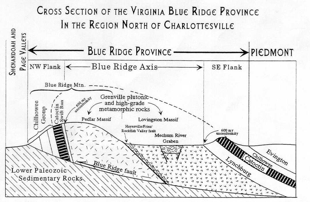
A masterful collection, this province bears rocks from each of the three major rock types- igneous, metamorphic and sedimentary. Structurally they fit together as an eroded anticline, overturned to the west. (See the diagram below). The core is comprised of igneous plutons and metabasalts, known collectivelly as the Grenville. At 1.2 billion, these represent Virginia's oldest rocks. Wrapped around this interior are the metamorphosed lava flows of the Catoctin Formation and sedimentaries of the Chilhowee Group. Click on the formation names to view a geologic biography of these rocks.
|
| - Taken from Dr. LS Fichter's Stratigraphy and Basin Analysis 1997
The Piedmont, because it is now relatively flat and topographically featureless, may seem uninteresting, but it contains some of the most fascinating rocks in the Virginia. There are two distinct divisions to the piedmont roks, one of mostly Paleozoic and older igneous and metamorphic rocks, and a secone of lower mesozoic (Triassic) sedimentary rocks deposited in basins faulted into the igneous and metamorphic rocks. The igneous and metamorphic rocks include the roots of several volcanic island chains (which, in their day, were comparable to volcanic islands like Japan, Borneo and Sumatra, and the Aleutian Islands), and several small continental fragments which are the roots of large mountains which once existed in the piedmont. Many of these pieces formed womewhere else and were brought to Virginia by later events. Because these rocks have been deformed and metamorphosed several times they are very complex. They also contain many economically important mineral deposits, including gold, talc, kyanite, and feldspar. The lower Mesozoic sediments deposited in fault basins are usually refered to as Triassic basin deposits, although they are now knowen to also contain lower Jurassic rocks. These basins fromed when Africa separated from North America to create the Atlantic ocean. The Culpepper basin marks an abrupt transition from the Blue Ridge to the Piedmont. Sometimes you know you have crossed into one of these basins because the rocks turn red, or there are coal beds, but often the evidence is subtler. The sediments filling the basins are ancient alluvial fan conglomerates along the western borders, but the deep red sediments to the east, often with fish fossils or criscrossed with dinosaur tracks, indicate the tropical lakes and mudflats which existed at the time. Cutting into the Triassic- Jurassic sediments are numerous igneous dikes, stocks (small bodies of igneous rock), and lava flows that accompanied the volcanic activity accompanying the opening of the Atlantic ocean. All in all, the piedmont contains evidence of a complex history of many intense geologic forces. |
| From its western border at the Fall Line to its eastern limit about 12,000 feet seaward of the Virginia coast, the Coastal Plain province is an eastward thickening wedge of Virginia's youngest sediments. Although the Piedmont extends beneath the Coastal Plain sediments, the Fall Line serves as a well defined surfucial division between the two provinces. Along this line (which extends south from Washington D.C. through Richmond and into North Carolina) occurs an abrupt change from high topography (west side) to low topography (east side). This transition mirrors a change from resistant Piedmont bedrock to the only partialy consolidated gravels, clays, shell debris and sands in the Coastal Plain. So abrupt is the transition that the Fall Line is recognizable as a zone of falls and rapids, with Great Falls in Northern Virginia as an impressive example.
Deposition of the Coastal Plain began in the Triassic (200mya) and numerous barrier islands off Virginia's coastal plain testament the continuation of this growth into the present. Working and reworking of coastal sediments changes the shoreline daily, making the Coastal Plain province a reminder to humans of their unlikely closeness to Earth's geological processes. |
 Cornered along the southwestern border of Virginia, in the counties of Buchanan, Dickenson and Wise, is the southern extent of the Alleghany Plateau.
The rocks here are flat lying
Cornered along the southwestern border of Virginia, in the counties of Buchanan, Dickenson and Wise, is the southern extent of the Alleghany Plateau.
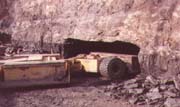
The rocks here are flat lying 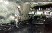 Although the Alleghany Plateau spans only a small portion of the state, its economic importance is unquestionable. Coal seams are replete within the