|
Satellite Image of the Red Sea
In this image the red sea is the black area in the lower part. A part of the Mediterranean is at the very top, Egypt on the left, Saudia Arabia on the right, and the Sinai Peninsula at the northern end of the red sea.The red sea is a newly opening ocean basin. Egypt and Saudia Arabia will move farther apart as the ocean basin opens. This image shows what the newly opening Proto-Atlantic ocean might have looked like just before the initiation of oceanic lithosphere generation. That is, the Red Sea is an axial rift. 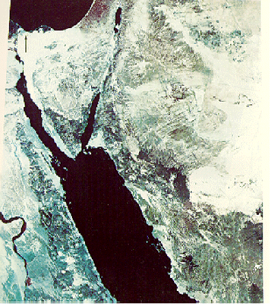 |